 vesseltracker.com
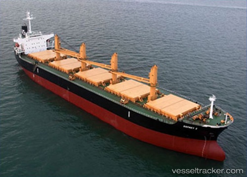
 ELIM CHALLENGE
Current Status
Where is the vessel?
ELIM CHALLENGE is currently in Near JINGTANG, based on AIS data received less than 1h ago.
Latest AIS update:
Current position: 39.20915° N, 118.99413° E (Near JINGTANG)
Average speed (last 7 days): Loading…
Average speed (last 30 days): Loading…
Vessel profile: ELIM CHALLENGE is a Bulk Carrier with dimensions 190m x 190m.
This page combines live AIS, route history, probable destination signals, nearby traffic, and port activity for practical vessel monitoring.
The current position of vessel ELIM CHALLENGE is 39.20915 lat / 118.99413 lng. Updated: 2026-04-08 09:29:01 UTCNearest reference points:
- Near JINGTANG
- Near CAOFEIDIAN
- 19 nm SE of JINGTANG
Currently sailing under the flag of Panama ![]()
ELIM CHALLENGE built in 2002 year
Deadweight:
50206 tDetails:
Live Vessel ELIM CHALLENGE Analytics (details, animations, etc.)
Recent AIS points (UTC):
2026-04-08 04:08:04 UTC · 39.20919, 118.99415 · SOG 0.1 kn · COG 250°2026-04-08 06:11:02 UTC · 39.20923, 118.99416 · SOG 0 kn · COG 250°
2026-04-08 07:35:59 UTC · 39.20918, 118.99412 · SOG 0 kn · COG -1°
2026-04-08 09:29:01 UTC · 39.20915, 118.99413 · SOG 0 kn · COG 250°