 vesseltracker.com
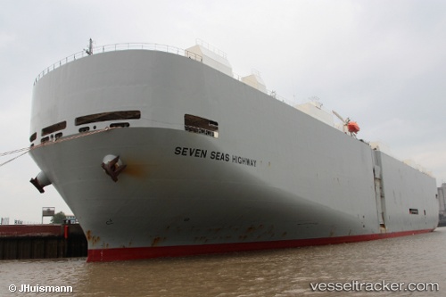
 Seven Seas Highway
Current Status
Where is the vessel?
Seven Seas Highway is currently in 27 nm SE of Caleta de Fuste, based on AIS data received about 3h ago.
Latest AIS update:
Current position: 28.03240° N, 13.54249° W (27 nm SE of Caleta de Fuste)
Average speed (last 7 days): Loading…
Average speed (last 30 days): Loading…
Vessel profile: Seven Seas Highway is a Vehicles Carrier with dimensions 200m x 200m.
This page combines live AIS, route history, probable destination signals, nearby traffic, and port activity for practical vessel monitoring.
The current position of vessel Seven Seas Highway is 28.03240 lat / -13.54249 lng. Updated: 2026-04-08 17:03:58 UTCNearest reference points:
- Near LAS COLORADAS
- Near Lanzarote
- Near Aaiun
Currently sailing under the flag of Panama ![]()
Seven Seas Highway built in 2001 year
Deadweight:
17232 tDetails:
Live Vessel Seven Seas Highway Analytics (details, animations, etc.)
Recent AIS points (UTC):
2026-04-08 14:14:11 UTC · 28.66067, -13.04795 · SOG 15.8 kn · COG 215°2026-04-08 16:08:59 UTC · 28.23921, -13.38102 · SOG 16.3 kn · COG 214°
2026-04-08 17:03:58 UTC · 28.03240, -13.54249 · SOG 16.6 kn · COG 219°
2026-04-08 17:03:58 UTC · 28.03240, -13.54249 · SOG 16.6 kn · COG 219°