 vesseltracker.com
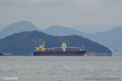
 Tamaki Princess
Current Status
Where is the vessel?
Tamaki Princess is currently in 128 nm W of Pulau Nias, based on AIS data received about 2h ago.
Latest AIS update:
Current position: 1.56553° N, 95.45512° E (128 nm W of Pulau Nias)
Average speed (last 7 days): Loading…
Average speed (last 30 days): Loading…
Vessel profile: Tamaki Princess is a General Cargo Ship with dimensions 104m x 19m.
This page combines live AIS, route history, probable destination signals, nearby traffic, and port activity for practical vessel monitoring.
The current position of vessel Tamaki Princess is 1.56553 lat / 95.45512 lng. Updated: 2026-04-20 21:38:12 UTCNearest reference points:
- 112 nm S of Calang
- 45 nm SE of Calang
Currently sailing under the flag of Panama ![]()
Tamaki Princess built in 2009 year
Deadweight:
10024 tDetails:
Live Vessel Tamaki Princess Analytics (details, animations, etc.)
Recent AIS points (UTC):
2026-04-20 11:33:29 UTC · 2.67822, 94.16748 · SOG 9.7 kn · COG 131°2026-04-20 11:33:29 UTC · 2.67822, 94.16748 · SOG 9.7 kn · COG 131°
2026-04-20 21:38:12 UTC · 1.56553, 95.45512 · SOG 10 kn · COG 135°
2026-04-20 21:38:12 UTC · 1.56553, 95.45512 · SOG 10 kn · COG 135°