 vesseltracker.com
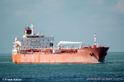
Al Amerat
Current StatusWhere is the vessel?
Al Amerat is currently in Open sea, approx. 419 nm off the nearest listed port, based on AIS data received less than 1h ago.
Latest AIS update:
Current position: 14.02423° N, 62.44065° E (Open sea, approx. 419 nm off the nearest listed port)
Average speed (last 7 days): Loading…
Average speed (last 30 days): Loading…
Vessel profile: Al Amerat is a Chemical Oil Products Tanker with dimensions 32m x 183m.
This page combines live AIS, route history, probable destination signals, nearby traffic, and port activity for practical vessel monitoring.
The current position of vessel Al Amerat is 14.02423 lat / 62.44065 lng. Updated: 2026-04-02 18:09:07 UTCNearest reference points:
- Open sea, approx. 419 nm off the nearest listed port
- Open sea, approx. 417 nm off the nearest listed port
- Open sea, approx. 414 nm off the nearest listed port
Details:
Live Vessel Al Amerat Analytics (details, animations, etc.)
Recent AIS points (UTC):
2026-04-02 11:46:24 UTC · 14.56833, 61.19667 · SOG 12 kn · COG -1°2026-04-02 13:22:27 UTC · 14.42667, 61.49667 · SOG 11 kn · COG -1°
2026-04-02 14:43:27 UTC · 14.31667, 61.75167 · SOG 12 kn · COG -1°
2026-04-02 18:09:07 UTC · 14.02423, 62.44065 · SOG 13 kn · COG 117°