 vesseltracker.com
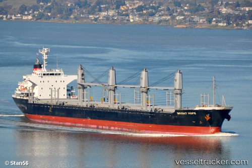
Bright Hope
Current StatusWhere is the vessel?
Bright Hope is currently in Near LANGADAI, based on AIS data received less than 1h ago.
Latest AIS update:
Current position: 3.28267° S, 116.11003° E (Near LANGADAI)
Average speed (last 7 days): Loading…
Average speed (last 30 days): Loading…
Vessel profile: Bright Hope is a Bulk Carrier with dimensions 27m x 170m.
This page combines live AIS, route history, probable destination signals, nearby traffic, and port activity for practical vessel monitoring.
The current position of vessel Bright Hope is -3.28267 lat / 116.11003 lng. Updated: 2026-04-10 01:39:58 UTCNearest reference points:
- Near TANJUNG PEMANCINGAN
- Near Bunati
- 12 nm SE of Bunati
Details:
Live Vessel Bright Hope Analytics (details, animations, etc.)
Recent AIS points (UTC):
2026-04-09 19:51:58 UTC · -3.28250, 116.11018 · SOG 0 kn · COG 245°2026-04-09 21:54:58 UTC · -3.28255, 116.11030 · SOG 0 kn · COG 245°
2026-04-10 00:12:58 UTC · -3.28248, 116.11028 · SOG 0 kn · COG 245°
2026-04-10 01:39:58 UTC · -3.28267, 116.11003 · SOG 0 kn · COG 246°