 vesseltracker.com
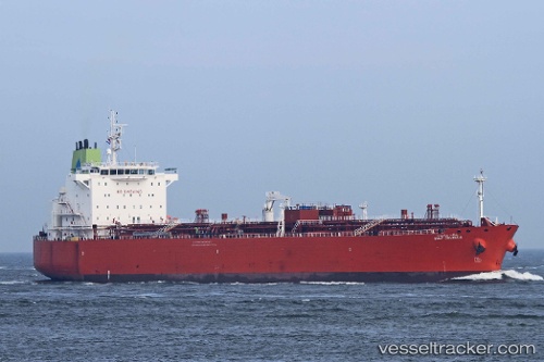
 GULF JALMUDA
Current Status
Where is the vessel?
GULF JALMUDA is currently in 181 nm SW of Veraval, based on AIS data received about 1h ago.
Latest AIS update:
Current position: 18.19382° N, 68.94523° E (181 nm SW of Veraval)
Average speed (last 7 days): Loading…
Average speed (last 30 days): Loading…
Vessel profile: GULF JALMUDA is a Oil Products Tanker with dimensions m x m.
This page combines live AIS, route history, probable destination signals, nearby traffic, and port activity for practical vessel monitoring.
The current position of vessel GULF JALMUDA is 18.19382 lat / 68.94523 lng. Updated: 2026-04-18 19:37:20 UTCNearest reference points:
- 236 nm SW of Veraval
- 306 nm SW of Veraval
- 282 nm W of RATNAGIRI
Currently sailing under the flag of Panama ![]()
Details:
Live Vessel GULF JALMUDA Analytics (details, animations, etc.)
Recent AIS points (UTC):
2026-04-18 13:48:21 UTC · 18.14453, 68.90577 · SOG 0.1 kn · COG 82°2026-04-18 15:56:40 UTC · 18.15552, 68.90390 · SOG 0.5 kn · COG 78°
2026-04-18 18:07:19 UTC · 18.18005, 68.91761 · SOG 1 kn · COG 70°
2026-04-18 19:37:20 UTC · 18.19382, 68.94523 · SOG 1.3 kn · COG 58°