 vesseltracker.com
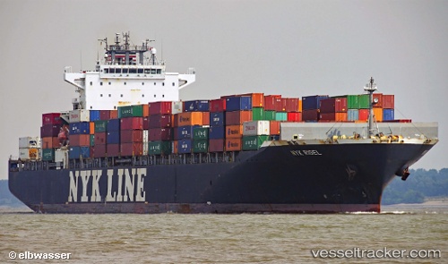
 NYK RIGEL
Current Status
Where is the vessel?
NYK RIGEL is currently in 56 nm NE of Romas, based on AIS data received about 1h ago.
Latest AIS update:
Current position: 46.31092° N, 23.61688° W (56 nm NE of Romas)
Average speed (last 7 days): Loading…
Average speed (last 30 days): Loading…
Vessel profile: NYK RIGEL is a Container Ship with dimensions 294m x 32m.
This page combines live AIS, route history, probable destination signals, nearby traffic, and port activity for practical vessel monitoring.
The current position of vessel NYK RIGEL is 46.31092 lat / -23.61688 lng. Updated: 2026-04-17 21:35:20 UTCCurrently sailing under the flag of Panama ![]()
NYK RIGEL built in 2009 year
Deadweight:
66051 tDetails:
Live Vessel NYK RIGEL Analytics (details, animations, etc.)
Recent AIS points (UTC):
2026-04-17 15:36:32 UTC · 45.80060, -25.31302 · SOG 12.9 kn · COG 64°2026-04-17 18:02:54 UTC · 46.01359, -24.61390 · SOG 13 kn · COG 69°
2026-04-17 20:22:29 UTC · 46.20926, -23.95486 · SOG 12.6 kn · COG 66°
2026-04-17 21:35:20 UTC · 46.31092, -23.61688 · SOG 12.8 kn · COG 66°