 vesseltracker.com
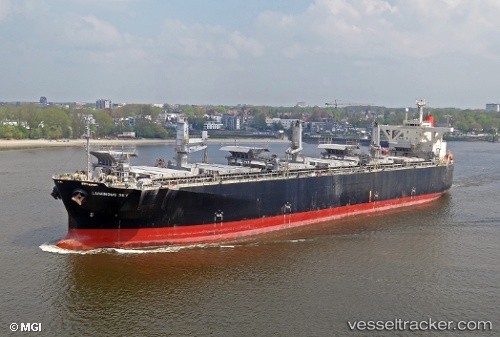
Luminous Sky
Current StatusWhere is the vessel?
Luminous Sky is currently in 83 nm SE of Xincun, based on AIS data received less than 1h ago.
Latest AIS update:
Current position: 17.37877° N, 110.86773° E (83 nm SE of Xincun)
Average speed (last 7 days): Loading…
Average speed (last 30 days): Loading…
Vessel profile: Luminous Sky is a Wood Chips Carrier with dimensions 37m x 203m.
This page combines live AIS, route history, probable destination signals, nearby traffic, and port activity for practical vessel monitoring.
The current position of vessel Luminous Sky is 17.37877 lat / 110.86773 lng. Updated: 2026-04-07 02:29:13 UTCNearest reference points:
- 37 nm SE of Houan
- 26 nm SE of Wanning
- 157 nm SE of Xincun
Details:
Live Vessel Luminous Sky Analytics (details, animations, etc.)
Recent AIS points (UTC):
2026-04-06 20:24:41 UTC · 17.90602, 111.63425 · SOG 9.4 kn · COG 225°2026-04-06 21:57:33 UTC · 17.74458, 111.44530 · SOG 9.2 kn · COG 225°
2026-04-07 00:25:13 UTC · 17.51011, 111.15303 · SOG 8.4 kn · COG 232°
2026-04-07 02:29:13 UTC · 17.37877, 110.86773 · SOG 9 kn · COG 236°