 vesseltracker.com
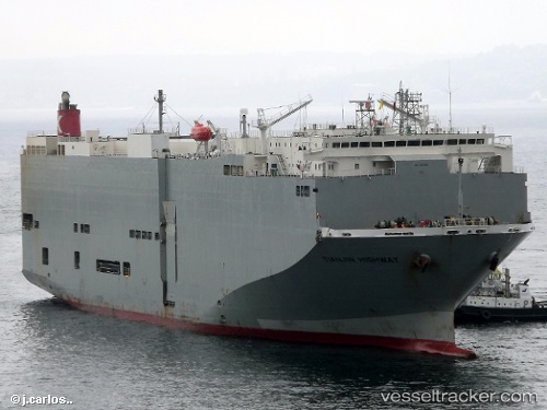
 Tianjin Highway
Current Status
Where is the vessel?
Tianjin Highway is currently in 173 nm SE of Lukovica pri Domzalah, based on AIS data received less than 1h ago.
Latest AIS update:
Current position: 43.96962° N, 141.68082° W (173 nm SE of Lukovica pri Domzalah)
Average speed (last 7 days): Loading…
Average speed (last 30 days): Loading…
Vessel profile: Tianjin Highway is a Vehicles Carrier with dimensions 180m x 32m.
This page combines live AIS, route history, probable destination signals, nearby traffic, and port activity for practical vessel monitoring.
The current position of vessel Tianjin Highway is 43.96962 lat / -141.68082 lng. Updated: 2026-04-09 13:32:07 UTCCurrently sailing under the flag of Panama ![]()
Tianjin Highway built in 2005 year
Deadweight:
15461 tDetails:
Live Vessel Tianjin Highway Analytics (details, animations, etc.)
Recent AIS points (UTC):
2026-04-09 07:37:04 UTC · 44.57716, -143.74783 · SOG 16.1 kn · COG 112°2026-04-09 09:26:47 UTC · 44.39192, -143.10811 · SOG 16.2 kn · COG 112°
2026-04-09 12:20:55 UTC · 44.09497, -142.09755 · SOG 16.3 kn · COG 112°
2026-04-09 13:32:07 UTC · 43.96962, -141.68082 · SOG 16.4 kn · COG 112°