 vesseltracker.com
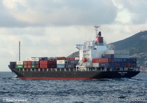
 Horai Bridge
Current Status
Where is the vessel?
Horai Bridge is currently in 61 nm SW of Kâmpóng Saôm, based on AIS data received less than 1h ago.
Latest AIS update:
Current position: 10.20753° N, 102.55877° E (61 nm SW of Kâmpóng Saôm)
Average speed (last 7 days): Loading…
Average speed (last 30 days): Loading…
Vessel profile: Horai Bridge is a Container Ship with dimensions 172m x 28m.
This page combines live AIS, route history, probable destination signals, nearby traffic, and port activity for practical vessel monitoring.
The current position of vessel Horai Bridge is 10.20753 lat / 102.55877 lng. Updated: 2026-04-18 21:36:40 UTCNearest reference points:
- 63 nm NW of Dai Hung (STS Load)
- 43 nm E of Benchamas
- Near KRONG PREAH SIHANOUK
Currently sailing under the flag of Panama ![]()
Horai Bridge built in 2009 year
Deadweight:
21922 tDetails:
Live Vessel Horai Bridge Analytics (details, animations, etc.)
Recent AIS points (UTC):
2026-04-18 15:39:36 UTC · 11.75282, 101.42625 · SOG 19 kn · COG 141°2026-04-18 18:13:53 UTC · 11.08617, 101.91203 · SOG 18.9 kn · COG 145°
2026-04-18 20:03:48 UTC · 10.60848, 102.26353 · SOG 19.5 kn · COG 145°
2026-04-18 21:36:40 UTC · 10.20753, 102.55877 · SOG 19.6 kn · COG -1°