 vesseltracker.com
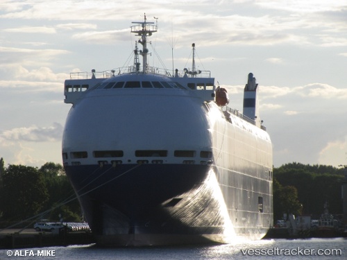
 City Of Rotterdam
Current Status
Where is the vessel?
City Of Rotterdam is currently in 21 nm N of Soto de la Marina, based on AIS data received about 2h ago.
Latest AIS update:
Current position: 43.80995° N, 3.87573° W (21 nm N of Soto de la Marina)
Average speed (last 7 days): Loading…
Average speed (last 30 days): Loading…
Vessel profile: City Of Rotterdam is a Vehicles Carrier with dimensions 140m x 22m.
This page combines live AIS, route history, probable destination signals, nearby traffic, and port activity for practical vessel monitoring.
The current position of vessel City Of Rotterdam is 43.80995 lat / -3.87573 lng. Updated: 2026-03-26 13:57:47 UTCNearest reference points:
- Near Mazcuerras
- Near LAREDO
- Near Zierbena
Currently sailing under the flag of Panama ![]()
City Of Rotterdam built in 2011 year
Deadweight:
5000 tDetails:
Live Vessel City Of Rotterdam Analytics (details, animations, etc.)
Recent AIS points (UTC):
2026-03-26 08:03:09 UTC · 43.43729, -3.81480 · SOG 0 kn · COG 185°2026-03-26 10:12:07 UTC · 43.43729, -3.81479 · SOG 0 kn · COG 185°
2026-03-26 11:48:25 UTC · 43.43775, -3.81376 · SOG 1.8 kn · COG 188°
2026-03-26 13:57:47 UTC · 43.80995, -3.87573 · SOG 14 kn · COG 341°