 vesseltracker.com
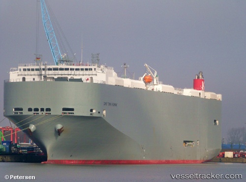
 Cape Town Highway
Current Status
Where is the vessel?
Cape Town Highway is currently in 20 nm NE of Ras Tannurah, based on AIS data received about 6h ago.
Latest AIS update:
Current position: 26.83427° N, 50.47070° E (20 nm NE of Ras Tannurah)
Average speed (last 7 days): Loading…
Average speed (last 30 days): Loading…
Vessel profile: Cape Town Highway is a Vehicles Carrier with dimensions 200m x 32m.
This page combines live AIS, route history, probable destination signals, nearby traffic, and port activity for practical vessel monitoring.
The current position of vessel Cape Town Highway is 26.83427 lat / 50.47070 lng. Updated: 2026-04-10 07:28:19 UTCNearest reference points:
- Near Ad Dammam
- Near DAMMAM
- Near Sayhat
Currently sailing under the flag of Panama ![]()
Cape Town Highway built in 2011 year
Deadweight:
21676 tDetails:
Live Vessel Cape Town Highway Analytics (details, animations, etc.)
Recent AIS points (UTC):
2026-04-10 02:28:02 UTC · 26.83453, 50.47063 · SOG 0 kn · COG 98°2026-04-10 03:58:27 UTC · 26.83457, 50.47062 · SOG 0 kn · COG 92°
2026-04-10 06:23:36 UTC · 26.83438, 50.47060 · SOG 0 kn · COG 75°
2026-04-10 07:28:19 UTC · 26.83427, 50.47070 · SOG 0 kn · COG 59°