 vesseltracker.com
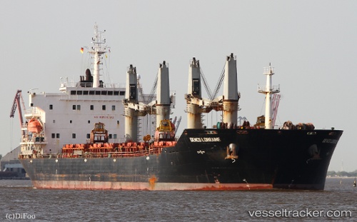
 AFRICA HOPE
Current Status
Where is the vessel?
AFRICA HOPE is currently in Near San Pedro, based on AIS data received less than 1h ago.
Latest AIS update:
Current position: 4.67998° N, 6.59087° W (Near San Pedro)
Average speed (last 7 days): Loading…
Average speed (last 30 days): Loading…
Vessel profile: AFRICA HOPE is a Bulk Carrier with dimensions 189m x 32m.
This page combines live AIS, route history, probable destination signals, nearby traffic, and port activity for practical vessel monitoring.
The current position of vessel AFRICA HOPE is 4.67998 lat / -6.59087 lng. Updated: 2026-04-21 22:33:46 UTCNearest reference points:
- Near Espoir
- 98 nm SW of Harper
Currently sailing under the flag of Panama ![]()
AFRICA HOPE built in 2009 year
Deadweight:
53416 tDetails:
Live Vessel AFRICA HOPE Analytics (details, animations, etc.)
Recent AIS points (UTC):
2026-04-21 19:00:46 UTC · 4.68010, -6.59133 · SOG 0.3 kn · COG 179°2026-04-21 19:21:41 UTC · 4.68012, -6.59123 · SOG 0.2 kn · COG 181°
2026-04-21 21:27:45 UTC · 4.67992, -6.59114 · SOG 0.3 kn · COG 191°
2026-04-21 22:33:46 UTC · 4.67998, -6.59087 · SOG 0.4 kn · COG 204°