 vesseltracker.com
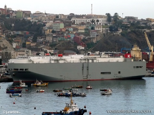
Sierra Nevada Hwy
Current StatusWhere is the vessel?
Sierra Nevada Hwy is currently in 95 nm SE of Lenard Harbour, based on AIS data received about 1d ago.
Latest AIS update:
Current position: 53.98234° N, 160.52187° W (95 nm SE of Lenard Harbour)
Average speed (last 7 days): Loading…
Average speed (last 30 days): Loading…
Vessel profile: Sierra Nevada Hwy is a Vehicles Carrier with dimensions 31m x 183m.
This page combines live AIS, route history, probable destination signals, nearby traffic, and port activity for practical vessel monitoring.
The current position of vessel Sierra Nevada Hwy is 53.98234 lat / -160.52187 lng. Updated: 2026-04-10 07:55:39 UTCNearest reference points:
- Near Lenard Harbour
Details:
Live Vessel Sierra Nevada Hwy Analytics (details, animations, etc.)
Recent AIS points (UTC):
2026-04-10 01:31:06 UTC · 53.67168, -157.71111 · SOG 15.4 kn · COG 281°2026-04-10 03:20:47 UTC · 53.76132, -158.48508 · SOG 15.9 kn · COG 281°
2026-04-10 05:56:12 UTC · 53.89559, -159.61957 · SOG 16 kn · COG 279°
2026-04-10 07:55:39 UTC · 53.98234, -160.52187 · SOG 16.2 kn · COG 275°