 vesseltracker.com
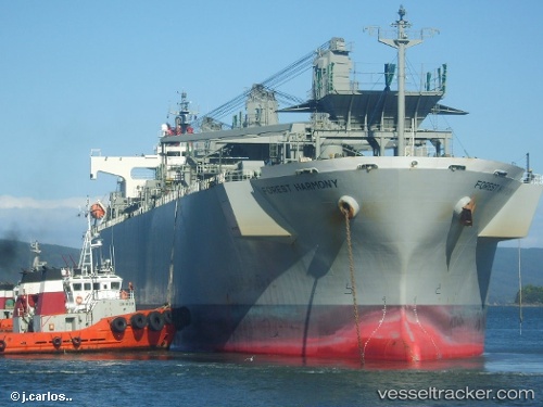
Forest Harmony
Current StatusWhere is the vessel?
Forest Harmony is currently in 58 nm NW of Sado Shima Apt, based on AIS data received about 1h ago.
Latest AIS update:
Current position: 38.57667° N, 137.36833° E (58 nm NW of Sado Shima Apt)
Average speed (last 7 days): Loading…
Average speed (last 30 days): Loading…
Vessel profile: Forest Harmony is a Wood Chips Carrier with dimensions 32m x 192m.
This page combines live AIS, route history, probable destination signals, nearby traffic, and port activity for practical vessel monitoring.
The current position of vessel Forest Harmony is 38.57667 lat / 137.36833 lng. Updated: 2026-04-13 02:29:54 UTCNearest reference points:
- 63 nm NW of Sado Shima Apt
- Near Toyama
Details:
Live Vessel Forest Harmony Analytics (details, animations, etc.)
Recent AIS points (UTC):
2026-04-12 18:41:54 UTC · 38.55833, 137.23167 · SOG 0 kn · COG -1°2026-04-12 21:50:59 UTC · 38.57500, 137.26833 · SOG 0 kn · COG -1°
2026-04-12 23:37:19 UTC · 38.58613, 137.30164 · SOG 0.9 kn · COG 106°
2026-04-13 02:29:54 UTC · 38.57667, 137.36833 · SOG 1 kn · COG -1°