 vesseltracker.com
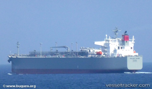
 Galaxy River
Current Status
Where is the vessel?
Galaxy River is currently in 162 nm SE of Toshima/Tokyo, based on AIS data received about 1h ago.
Latest AIS update:
Current position: 32.13759° N, 140.77240° E (162 nm SE of Toshima/Tokyo)
Average speed (last 7 days): Loading…
Average speed (last 30 days): Loading…
Vessel profile: Galaxy River is a Lpg Tanker with dimensions 230m x 230m.
This page combines live AIS, route history, probable destination signals, nearby traffic, and port activity for practical vessel monitoring.
The current position of vessel Galaxy River is 32.13759 lat / 140.77240 lng. Updated: 2026-04-09 17:24:12 UTCNearest reference points:
- Near Toshima/Tokyo
- 10 nm SE of Iruma
- Near Iruma
Currently sailing under the flag of Panama ![]()
Details:
Live Vessel Galaxy River Analytics (details, animations, etc.)
Recent AIS points (UTC):
2026-04-09 11:02:26 UTC · 32.04736, 142.48846 · SOG 13.6 kn · COG 269°2026-04-09 14:02:53 UTC · 32.07827, 141.66740 · SOG 14 kn · COG 277°
2026-04-09 15:40:06 UTC · 32.11435, 141.23676 · SOG 13.8 kn · COG 272°
2026-04-09 17:24:12 UTC · 32.13759, 140.77240 · SOG 13.3 kn · COG 271°