 vesseltracker.com
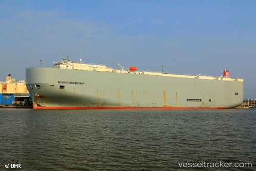
 Bosporus Highway
Current Status
Where is the vessel?
Bosporus Highway is currently in 147 nm SE of Tamatave, based on AIS data received about 1h ago.
Latest AIS update:
Current position: 19.95396° S, 51.17763° E (147 nm SE of Tamatave)
Average speed (last 7 days): Loading…
Average speed (last 30 days): Loading…
Vessel profile: Bosporus Highway is a Vehicles Carrier with dimensions 199m x 199m.
This page combines live AIS, route history, probable destination signals, nearby traffic, and port activity for practical vessel monitoring.
The current position of vessel Bosporus Highway is -19.95396 lat / 51.17763 lng. Updated: 2026-03-31 21:58:35 UTCCurrently sailing under the flag of Panama ![]()
Bosporus Highway built in 2009 year
Deadweight:
18792 tDetails:
Live Vessel Bosporus Highway Analytics (details, animations, etc.)
Recent AIS points (UTC):
2026-03-31 15:55:56 UTC · -21.36243, 50.27317 · SOG 16.1 kn · COG 33°2026-03-31 18:21:47 UTC · -20.80747, 50.64382 · SOG 16.4 kn · COG 29°
2026-03-31 19:35:34 UTC · -20.51514, 50.82143 · SOG 16.4 kn · COG 32°
2026-03-31 21:58:35 UTC · -19.95396, 51.17763 · SOG 16.7 kn · COG 35°