 vesseltracker.com
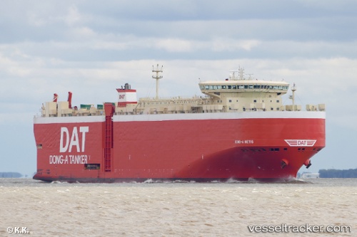
 Dong A Metis
Current Status
Where is the vessel?
Dong A Metis is currently in 17 nm NW of Hunsdon, based on AIS data received about 1h ago.
Latest AIS update:
Current position: 51.99704° N, 2.92344° E (17 nm NW of Hunsdon)
Average speed (last 7 days): Loading…
Average speed (last 30 days): Loading…
Vessel profile: Dong A Metis is a Vehicles Carrier with dimensions 199m x 32m.
This page combines live AIS, route history, probable destination signals, nearby traffic, and port activity for practical vessel monitoring.
The current position of vessel Dong A Metis is 51.99704 lat / 2.92344 lng. Updated: 2026-04-22 10:41:42 UTCNearest reference points:
- Near Hunsdon
- 21 nm S of Craven Arms
- Near Thorntonbank
Currently sailing under the flag of Panama ![]()
Dong A Metis built in 2010 year
Deadweight:
22582 tDetails:
Live Vessel Dong A Metis Analytics (details, animations, etc.)
Recent AIS points (UTC):
2026-04-22 07:36:03 UTC · 51.47761, 2.68056 · SOG 12.1 kn · COG 350°2026-04-22 08:19:42 UTC · 51.61462, 2.71970 · SOG 11.5 kn · COG 15°
2026-04-22 09:29:03 UTC · 51.82233, 2.71131 · SOG 10.5 kn · COG 30°
2026-04-22 10:41:42 UTC · 51.99704, 2.92344 · SOG 13.1 kn · COG 40°