 vesseltracker.com
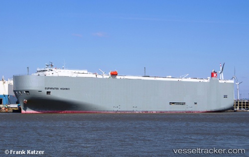
 Euphrates Highway
Current Status
Where is the vessel?
Euphrates Highway is currently in Near DUNDALK, based on AIS data received about 1h ago.
Latest AIS update:
Current position: 39.25590° N, 76.53556° W (Near DUNDALK)
Average speed (last 7 days): Loading…
Average speed (last 30 days): Loading…
Vessel profile: Euphrates Highway is a Vehicles Carrier with dimensions 199m x 199m.
This page combines live AIS, route history, probable destination signals, nearby traffic, and port activity for practical vessel monitoring.
The current position of vessel Euphrates Highway is 39.25590 lat / -76.53556 lng. Updated: 2026-04-19 22:36:28 UTCNearest reference points:
- Near DUNDALK
- Near Baltimore
- Near South Baltimore
Currently sailing under the flag of Panama ![]()
Euphrates Highway built in 2012 year
Deadweight:
18668 tDetails:
Live Vessel Euphrates Highway Analytics (details, animations, etc.)
Recent AIS points (UTC):
2026-04-19 20:03:28 UTC · 39.25590, -76.53557 · SOG 0 kn · COG 14°2026-04-19 20:06:28 UTC · 39.25588, -76.53560 · SOG 0 kn · COG 14°
2026-04-19 21:33:27 UTC · 39.25588, -76.53555 · SOG 0 kn · COG 14°
2026-04-19 22:36:28 UTC · 39.25590, -76.53556 · SOG 0 kn · COG 14°