 vesseltracker.com
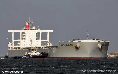
 Cape Valencia
Current Status
Where is the vessel?
Cape Valencia is currently in 144 nm NE of Cap Malheureux, based on AIS data received about 4h ago.
Latest AIS update:
Current position: 18.41868° S, 59.51563° E (144 nm NE of Cap Malheureux)
Average speed (last 7 days): Loading…
Average speed (last 30 days): Loading…
Vessel profile: Cape Valencia is a Bulk Carrier with dimensions 292m x 45m.
This page combines live AIS, route history, probable destination signals, nearby traffic, and port activity for practical vessel monitoring.
The current position of vessel Cape Valencia is -18.41868 lat / 59.51563 lng. Updated: 2026-04-10 07:01:47 UTCNearest reference points:
- 159 nm W of Rodrigues
- Near Port Louis
- 219 nm NW of Port Mathurin
Currently sailing under the flag of Panama ![]()
Cape Valencia built in 2012 year
Deadweight:
181434 tDetails:
Live Vessel Cape Valencia Analytics (details, animations, etc.)
Recent AIS points (UTC):
2026-04-10 01:55:06 UTC · -17.73637, 60.46649 · SOG 13.6 kn · COG 232°2026-04-10 03:32:25 UTC · -17.95685, 60.17125 · SOG 13.1 kn · COG 234°
2026-04-10 06:09:56 UTC · -18.30117, 59.67432 · SOG 13.5 kn · COG 230°
2026-04-10 07:01:47 UTC · -18.41868, 59.51563 · SOG 13.2 kn · COG 231°