 vesseltracker.com
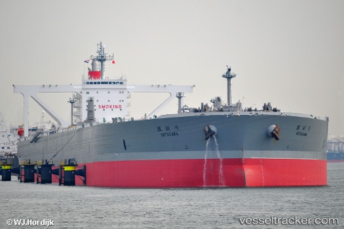
Setagawa
Current StatusWhere is the vessel?
Setagawa is currently in 276 nm E of Abakaliki, based on AIS data received about 1h ago.
Latest AIS update:
Current position: 5.53333° N, 90.55167° E (276 nm E of Abakaliki)
Average speed (last 7 days): Loading…
Average speed (last 30 days): Loading…
Vessel profile: Setagawa is a Crude Oil Tanker with dimensions 60m x 333m.
This page combines live AIS, route history, probable destination signals, nearby traffic, and port activity for practical vessel monitoring.
The current position of vessel Setagawa is 5.53333 lat / 90.55167 lng. Updated: 2026-04-03 05:54:39 UTCNearest reference points:
- 243 nm E of Abakaliki
- 172 nm W of LHOKNGA
- 160 nm W of Sebang
Details:
Live Vessel Setagawa Analytics (details, animations, etc.)
Recent AIS points (UTC):
2026-04-03 00:18:38 UTC · 5.52833, 89.25833 · SOG 14 kn · COG -1°2026-04-03 01:36:37 UTC · 5.52667, 89.56833 · SOG 13 kn · COG -1°
2026-04-03 03:27:58 UTC · 5.53393, 89.99834 · SOG 13.5 kn · COG -1°
2026-04-03 05:54:39 UTC · 5.53333, 90.55167 · SOG 13 kn · COG -1°