 vesseltracker.com
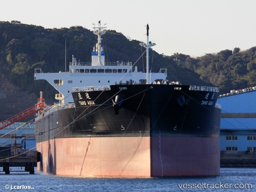
Taho Asia
Current StatusWhere is the vessel?
Taho Asia is currently in 271 nm SW of Caufield North, based on AIS data received about 2h ago.
Latest AIS update:
Current position: 39.95735° S, 9.71803° E (271 nm SW of Caufield North)
Average speed (last 7 days): Loading…
Average speed (last 30 days): Loading…
Vessel profile: Taho Asia is a Bulk Carrier with dimensions 36m x 228m.
This page combines live AIS, route history, probable destination signals, nearby traffic, and port activity for practical vessel monitoring.
The current position of vessel Taho Asia is -39.95735 lat / 9.71803 lng. Updated: 2026-04-07 07:23:48 UTCNearest reference points:
- Open sea, approx. 413 nm off the nearest listed port
Details:
Live Vessel Taho Asia Analytics (details, animations, etc.)
Recent AIS points (UTC):
2026-04-07 01:27:42 UTC · -39.95270, 8.43163 · SOG 10.2 kn · COG 90°2026-04-07 04:14:23 UTC · -39.95591, 9.03951 · SOG 10 kn · COG 87°
2026-04-07 06:18:31 UTC · -39.95808, 9.48413 · SOG 9.7 kn · COG 82°
2026-04-07 07:23:48 UTC · -39.95735, 9.71803 · SOG 9.9 kn · COG 84°