 vesseltracker.com
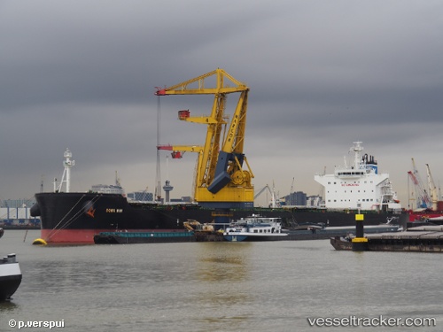
 Dona Bibi
Current Status
Where is the vessel?
Dona Bibi is currently in 278 nm NW of Tinaquillo, based on AIS data received about 2h ago.
Latest AIS update:
Current position: 13.98134° N, 66.03086° E (278 nm NW of Tinaquillo)
Average speed (last 7 days): Loading…
Average speed (last 30 days): Loading…
Vessel profile: Dona Bibi is a Bulk Carrier with dimensions 229m x 229m.
This page combines live AIS, route history, probable destination signals, nearby traffic, and port activity for practical vessel monitoring.
The current position of vessel Dona Bibi is 13.98134 lat / 66.03086 lng. Updated: 2026-04-12 20:13:32 UTCNearest reference points:
- 187 nm N of Tinaquillo
- Open sea, approx. 401 nm off the nearest listed port
- Open sea, approx. 403 nm off the nearest listed port
Currently sailing under the flag of Panama ![]()
Details:
Live Vessel Dona Bibi Analytics (details, animations, etc.)
Recent AIS points (UTC):
2026-04-12 13:22:52 UTC · 15.34833, 66.39440 · SOG 12.2 kn · COG 223°2026-04-12 15:42:31 UTC · 14.91365, 66.22097 · SOG 12.3 kn · COG 192°
2026-04-12 17:16:42 UTC · 14.58788, 66.16709 · SOG 12.7 kn · COG 192°
2026-04-12 20:13:32 UTC · 13.98134, 66.03086 · SOG 12.6 kn · COG 197°