 vesseltracker.com
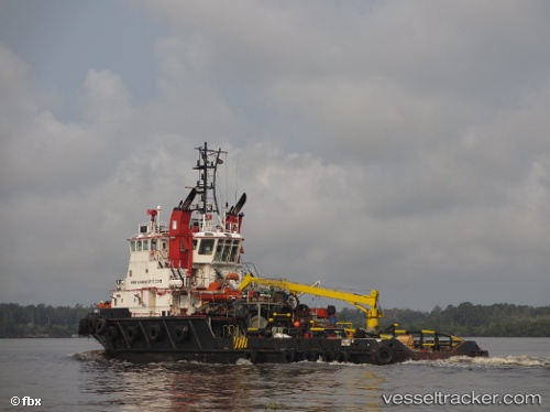
 ADVANTIS LIBRA
Current Status
Where is the vessel?
ADVANTIS LIBRA is currently in Near Trincomalee, based on AIS data received about 1d ago.
Latest AIS update:
Current position: 8.56095° N, 81.32835° E (Near Trincomalee)
Average speed (last 7 days): Loading…
Average speed (last 30 days): Loading…
Vessel profile: ADVANTIS LIBRA is a Tug with dimensions m x m.
This page combines live AIS, route history, probable destination signals, nearby traffic, and port activity for practical vessel monitoring.
The current position of vessel ADVANTIS LIBRA is 8.56095 lat / 81.32835 lng. Updated: 2026-04-10 04:34:13 UTCNearest reference points:
- 67 nm E of Oluvil
- 42 nm E of Konwelana
- 40 nm E of Konwelana
Currently sailing under the flag of Saint Vincent and the Grenadines ![]()
Details:
Live Vessel ADVANTIS LIBRA Analytics (details, animations, etc.)
Recent AIS points (UTC):
2026-04-10 01:42:53 UTC · 8.54205, 81.22062 · SOG 8.3 kn · COG 342°2026-04-10 04:10:24 UTC · 8.53978, 81.27770 · SOG 7.8 kn · COG 71°
2026-04-10 04:34:13 UTC · 8.56095, 81.32835 · SOG 8.6 kn · COG 69°
2026-04-10 04:34:13 UTC · 8.56095, 81.32835 · SOG 8.6 kn · COG 69°