 vesseltracker.com
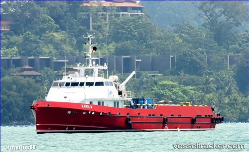
Karol W
Current StatusWhere is the vessel?
Karol W is currently in 25 nm W of Pointe Noire, based on AIS data received less than 1h ago.
Latest AIS update:
Current position: 4.75038° S, 11.41022° E (25 nm W of Pointe Noire)
Average speed (last 7 days): Loading…
Average speed (last 30 days): Loading…
Vessel profile: Karol W is a Offshore Tug Supply Ship with dimensions 10m x 54m.
This page combines live AIS, route history, probable destination signals, nearby traffic, and port activity for practical vessel monitoring.
The current position of vessel Karol W is -4.75038 lat / 11.41022 lng. Updated: 2026-04-22 07:35:55 UTCNearest reference points:
- Near Pointe Noire
- Near N'Kossa Terminal
- Near Futila Terminal
Details:
Live Vessel Karol W Analytics (details, animations, etc.)
Recent AIS points (UTC):
2026-04-22 03:09:14 UTC · -4.78419, 11.44050 · SOG 0.6 kn · COG -1°2026-04-22 04:14:34 UTC · -4.78406, 11.44058 · SOG 0.6 kn · COG -1°
2026-04-22 05:30:09 UTC · -4.78412, 11.44052 · SOG 0.2 kn · COG -1°
2026-04-22 07:35:55 UTC · -4.75038, 11.41022 · SOG 1.2 kn · COG -1°