 vesseltracker.com
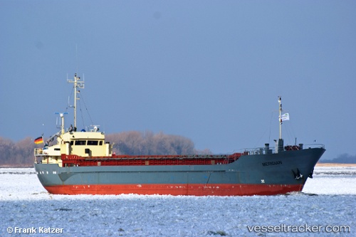
 KOOLE K
Current Status
Where is the vessel?
KOOLE K is currently in Near Claxton Bay, based on AIS data received about 1h ago.
Latest AIS update:
Current position: 10.35319° N, 61.47762° W (Near Claxton Bay)
Average speed (last 7 days): Loading…
Average speed (last 30 days): Loading…
Vessel profile: KOOLE K is a General Cargo with dimensions m x m.
This page combines live AIS, route history, probable destination signals, nearby traffic, and port activity for practical vessel monitoring.
The current position of vessel KOOLE K is 10.35319 lat / -61.47762 lng. Updated: 2026-04-12 23:38:37 UTCNearest reference points:
- Near POINT LISAS
- Near Caroni
- Near Carenage
Currently sailing under the flag of Saint Vincent and the Grenadines ![]()
Details:
Live Vessel KOOLE K Analytics (details, animations, etc.)
Recent AIS points (UTC):
2026-04-12 18:20:38 UTC · 10.35305, -61.47762 · SOG 0.6 kn · COG 82°2026-04-12 20:11:38 UTC · 10.35274, -61.47763 · SOG 1 kn · COG 58°
2026-04-12 21:44:38 UTC · 10.35304, -61.47752 · SOG 0.6 kn · COG 132°
2026-04-12 23:38:37 UTC · 10.35319, -61.47762 · SOG 0.1 kn · COG 124°