 vesseltracker.com
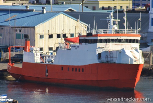
 ADMIRAL BAY 2
Current Status
Where is the vessel?
ADMIRAL BAY 2 is currently in Near Carriacou Apt, based on AIS data received about 5d ago.
Latest AIS update:
Current position: 12.39683° N, 61.61134° W (Near Carriacou Apt)
Average speed (last 7 days): Loading…
Average speed (last 30 days): Loading…
Vessel profile: ADMIRAL BAY 2 is a Ro-Ro/Passenger Ship with dimensions m x m.
This page combines live AIS, route history, probable destination signals, nearby traffic, and port activity for practical vessel monitoring.
The current position of vessel ADMIRAL BAY 2 is 12.39683 lat / -61.61134 lng. Updated: 2026-04-10 08:13:37 UTCNearest reference points:
- 16 nm SW of Carriacou Apt
- Near St. Georges
- Near ST GEORGES
Currently sailing under the flag of Saint Vincent and the Grenadines ![]()
Details:
Live Vessel ADMIRAL BAY 2 Analytics (details, animations, etc.)
Recent AIS points (UTC):
2026-04-10 01:26:54 UTC · 11.27178, -61.72694 · SOG 10.4 kn · COG -1°2026-04-10 03:46:05 UTC · 11.66871, -61.77128 · SOG 9.4 kn · COG -1°
2026-04-10 05:39:24 UTC · 11.99249, -61.80739 · SOG 10.4 kn · COG -1°
2026-04-10 08:13:37 UTC · 12.39683, -61.61134 · SOG 9.9 kn · COG -1°