 vesseltracker.com
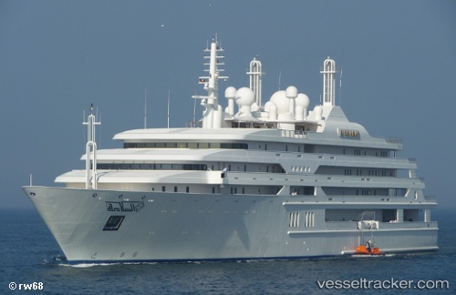
Al Salamah
Current StatusWhere is the vessel?
Al Salamah is currently in 19 nm NE of Al Gurdagah, based on AIS data received about 53d ago.
Latest AIS update:
Current position: 27.53798° N, 34.02554° E (19 nm NE of Al Gurdagah)
Average speed (last 7 days): Loading…
Average speed (last 30 days): Loading…
Vessel profile: Al Salamah is a Service Ship with dimensions 24m x 140m.
This page combines live AIS, route history, probable destination signals, nearby traffic, and port activity for practical vessel monitoring.
The current position of vessel Al Salamah is 27.53798 lat / 34.02554 lng. Updated: 2026-02-23 21:42:42 UTCNearest reference points:
- 19 nm SE of Zeit Bay
- Near El-Guna (El Gouna)
- Near Bur Safaga
Details:
Live Vessel Al Salamah Analytics (details, animations, etc.)
Recent AIS points (UTC):
2026-02-23 21:42:42 UTC · 27.53798, 34.02554 · SOG 15.2 kn · COG 136°