 vesseltracker.com
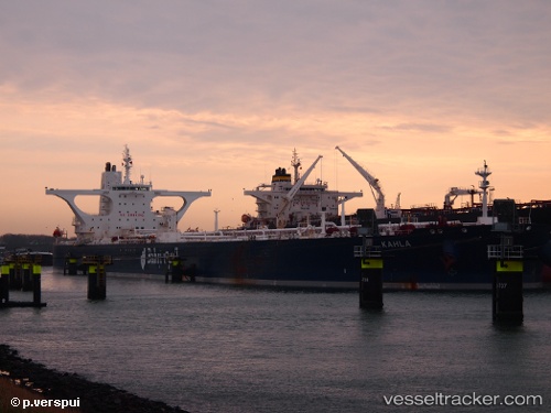
 KAHLA
KAHLA
Current Status
Where is the vessel?
KAHLA is currently in 131 nm NW of Kulhudhuffushi, based on AIS data received about 5h ago.
Latest AIS update:
Current position: 8.34343° N, 71.71452° E (131 nm NW of Kulhudhuffushi)
Average speed (last 7 days): Loading…
Average speed (last 30 days): Loading…
Vessel profile: KAHLA is a Crude Oil Tanker with dimensions 333m x 60m.
This page combines live AIS, route history, probable destination signals, nearby traffic, and port activity for practical vessel monitoring.
The current position of vessel KAHLA is 8.34343 lat / 71.71452 lng. Updated: 2026-04-13 01:47:12 UTCNearest reference points:
- 130 nm W of Lakshadweep
- 119 nm SE of Tinaquillo
- 45 nm SW of Kalpeni Island
Currently sailing under the flag of Saudi Arabia ![]()
KAHLA built in 2009 year
Deadweight:
317521 tDetails:
Live Vessel KAHLA Analytics (details, animations, etc.)
Recent AIS points (UTC):
2026-04-12 23:08:00 UTC · 8.50165, 71.14590 · SOG 13.1 kn · COG 107°2026-04-13 01:47:12 UTC · 8.34343, 71.71452 · SOG 13.4 kn · COG 108°
2026-04-13 01:47:12 UTC · 8.34343, 71.71452 · SOG 13.4 kn · COG 108°
2026-04-13 01:47:12 UTC · 8.34343, 71.71452 · SOG 13.4 kn · COG 108°