 vesseltracker.com
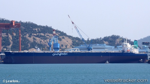
Maharah
Current StatusWhere is the vessel?
Maharah is currently in Near Banting, based on AIS data received less than 1h ago.
Latest AIS update:
Current position: 2.74818° N, 101.33393° E (Near Banting)
Average speed (last 7 days): Loading…
Average speed (last 30 days): Loading…
Vessel profile: Maharah is a Crude Oil Tanker with dimensions 60m x 333m.
This page combines live AIS, route history, probable destination signals, nearby traffic, and port activity for practical vessel monitoring.
The current position of vessel Maharah is 2.74818 lat / 101.33393 lng. Updated: 2026-04-05 14:20:48 UTCNearest reference points:
- Near Carey Island Estate
- Near Pulau Indah
- Near Banting
Details:
Live Vessel Maharah Analytics (details, animations, etc.)
Recent AIS points (UTC):
2026-04-05 07:51:39 UTC · 2.75229, 101.33007 · SOG 0.1 kn · COG 142°2026-04-05 09:51:39 UTC · 2.74893, 101.33434 · SOG 0 kn · COG 294°
2026-04-05 11:18:39 UTC · 2.74849, 101.33429 · SOG 0.1 kn · COG 301°
2026-04-05 14:20:48 UTC · 2.74818, 101.33393 · SOG 0.1 kn · COG 306°