 vesseltracker.com
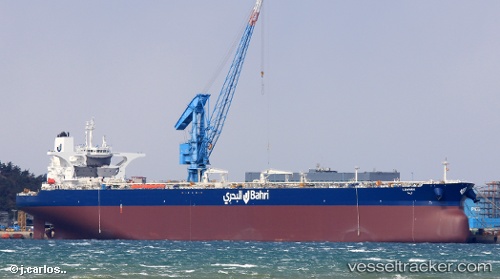
 LAWHAH
Current Status
Where is the vessel?
LAWHAH is currently in 33 nm NE of Offshore Corpus Christi, based on AIS data received about 1h ago.
Latest AIS update:
Current position: 27.72746° N, 96.27636° W (33 nm NE of Offshore Corpus Christi)
Average speed (last 7 days): Loading…
Average speed (last 30 days): Loading…
Vessel profile: LAWHAH is a Tanker with dimensions m x m.
This page combines live AIS, route history, probable destination signals, nearby traffic, and port activity for practical vessel monitoring.
The current position of vessel LAWHAH is 27.72746 lat / -96.27636 lng. Updated: 2026-04-19 01:39:13 UTCNearest reference points:
- 10 nm E of Port Aransas
- Near Matagorda Bay
- Near Port Aransas
Currently sailing under the flag of Saudi Arabia ![]()
Details:
Live Vessel LAWHAH Analytics (details, animations, etc.)
Recent AIS points (UTC):
2026-04-18 20:16:27 UTC · 27.75306, -96.20077 · SOG 0.6 kn · COG -1°2026-04-18 21:44:12 UTC · 27.74600, -96.21581 · SOG 0.7 kn · COG 206°
2026-04-18 23:58:22 UTC · 27.73184, -96.24767 · SOG 0.9 kn · COG 197°
2026-04-19 01:39:13 UTC · 27.72746, -96.27636 · SOG 0.9 kn · COG 192°