 vesseltracker.com
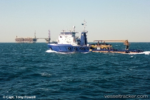
Ain Dar 3
Current StatusWhere is the vessel?
Ain Dar 3 is currently in 14 nm SE of Al Jubayl, based on AIS data received less than 1h ago.
Latest AIS update:
Current position: 26.86252° N, 49.90745° E (14 nm SE of Al Jubayl)
Average speed (last 7 days): Loading…
Average speed (last 30 days): Loading…
Vessel profile: Ain Dar 3 is a Pollution Control Vessel with dimensions 14m x 57m.
This page combines live AIS, route history, probable destination signals, nearby traffic, and port activity for practical vessel monitoring.
The current position of vessel Ain Dar 3 is 26.86252 lat / 49.90745 lng. Updated: 2026-04-19 13:58:11 UTCNearest reference points:
- Near Al Jubayl
- Near Sayhat
- Near DAMMAM
Details:
Live Vessel Ain Dar 3 Analytics (details, animations, etc.)
Recent AIS points (UTC):
2026-04-19 10:08:11 UTC · 26.86250, 49.90747 · SOG 0 kn · COG 18°2026-04-19 11:51:00 UTC · 26.86167, 49.90667 · SOG 0 kn · COG -1°
2026-04-19 13:33:10 UTC · 26.86249, 49.90745 · SOG 0 kn · COG 18°
2026-04-19 13:58:11 UTC · 26.86252, 49.90745 · SOG 0 kn · COG 18°