 vesseltracker.com
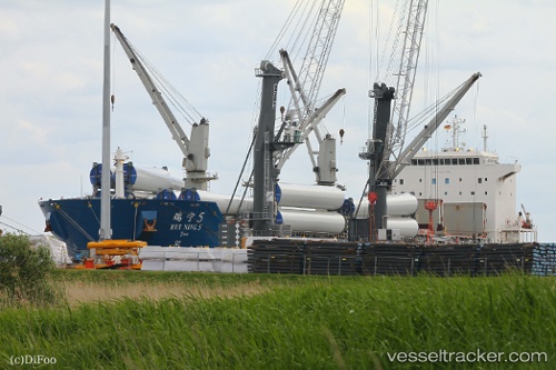
 RUI NING 5
Current Status
Where is the vessel?
RUI NING 5 is currently in 121 nm W of Hongdo, based on AIS data received about 5h ago.
Latest AIS update:
Current position: 34.66370° N, 122.72621° E (121 nm W of Hongdo)
Average speed (last 7 days): Loading…
Average speed (last 30 days): Loading…
Vessel profile: RUI NING 5 is a Cargo with dimensions m x m.
This page combines live AIS, route history, probable destination signals, nearby traffic, and port activity for practical vessel monitoring.
The current position of vessel RUI NING 5 is 34.66370 lat / 122.72621 lng. Updated: 2026-04-12 20:53:21 UTCNearest reference points:
- 116 nm NE of DAFENG
- 111 nm W of Gageohyangri
- 103 nm NE of DAFENG
Currently sailing under the flag of China ![]()
Details:
Live Vessel RUI NING 5 Analytics (details, animations, etc.)
Recent AIS points (UTC):
2026-04-12 16:59:50 UTC · 35.39865, 122.80075 · SOG 11 kn · COG 196°2026-04-12 16:59:50 UTC · 35.39865, 122.80075 · SOG 11 kn · COG 196°
2026-04-12 20:53:21 UTC · 34.66370, 122.72621 · SOG 11.7 kn · COG 179°
2026-04-12 20:53:21 UTC · 34.66370, 122.72621 · SOG 11.7 kn · COG 179°