 vesseltracker.com
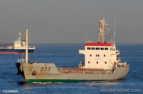
 JIAN YANG HONG
Current Status
Where is the vessel?
JIAN YANG HONG is currently in 23 nm E of Jiuzhen, based on AIS data received about 3d ago.
Latest AIS update:
Current position: 23.96591° N, 118.11509° E (23 nm E of Jiuzhen)
Average speed (last 7 days): Loading…
Average speed (last 30 days): Loading…
Vessel profile: JIAN YANG HONG is a General Cargo Ship with dimensions 80m x 80m.
This page combines live AIS, route history, probable destination signals, nearby traffic, and port activity for practical vessel monitoring.
The current position of vessel JIAN YANG HONG is 23.96591 lat / 118.11509 lng. Updated: 2026-04-09 04:37:11 UTCNearest reference points:
- 23 nm S of Xiamen Pt
- 17 nm E of Jiuzhen
- 18 nm E of Jiuzhen
Currently sailing under the flag of China Peopless Republic ![]()
JIAN YANG HONG built in 2003 year
Deadweight:
2850 tDetails:
Live Vessel JIAN YANG HONG Analytics (details, animations, etc.)
Recent AIS points (UTC):
2026-04-02 13:45:35 UTC · 23.60333, 117.65862 · SOG 2.9 kn · COG 67°2026-04-09 04:37:11 UTC · 23.96591, 118.11509 · SOG 28.2 kn · COG 40°
2026-04-09 04:37:11 UTC · 23.96591, 118.11509 · SOG 28.2 kn · COG 40°
2026-04-09 04:37:11 UTC · 23.96591, 118.11509 · SOG 28.2 kn · COG 40°