 vesseltracker.com
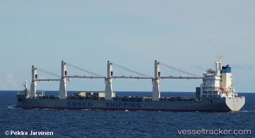
Vessel Tian Qi IMO: 9722742, MMSI: 412478720 General Cargo Ship
UTC, 31.84333, 31.79833, course: -1, speed: 12
UTC, 32.20267, 31.37911, course: -1, speed: 11.5
2026-02-28 01:40:45 UTC, 32.43887, 31.14316, course: -1, speed: 12.1
Live AIS position:
UTC. 46 nm NW of Bnei Darom),
updated 2026-02-28 01:40:45 UTC.
Find the position of the vessel Tian Qi on the map. The latter are known coordinates and path.
marine traffic ship tracker show on live map
The current position of vessel Tian Qi is 32.43887 lat / 31.14316 lng. Updated: 2026-02-28 01:40:45 UTCDetails:
Last coordinates of the vessel:
UTC, 31.71584, 32.02855, course: -1, speed: 12.1UTC, 31.84333, 31.79833, course: -1, speed: 12
UTC, 32.20267, 31.37911, course: -1, speed: 11.5
2026-02-28 01:40:45 UTC, 32.43887, 31.14316, course: -1, speed: 12.1