 vesseltracker.com
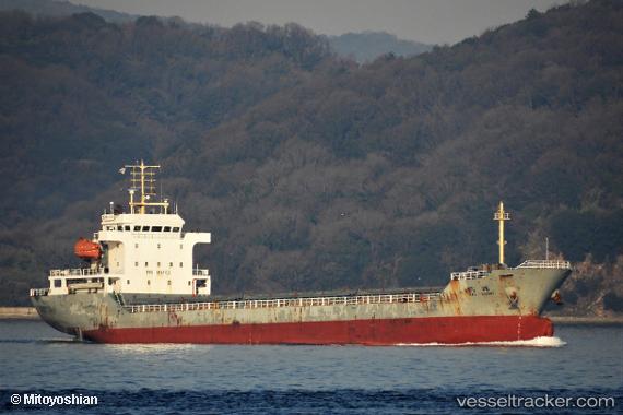
 HE HUI
Current Status
Where is the vessel?
HE HUI is currently in 46 nm E of Shipu, based on AIS data received about 1h ago.
Latest AIS update:
Current position: 29.28057° N, 122.69087° E (46 nm E of Shipu)
Average speed (last 7 days): Loading…
Average speed (last 30 days): Loading…
Vessel profile: HE HUI is a General Cargo Ship with dimensions 120m x 119m.
This page combines live AIS, route history, probable destination signals, nearby traffic, and port activity for practical vessel monitoring.
The current position of vessel HE HUI is 29.28057 lat / 122.69087 lng. Updated: 2026-04-20 17:45:59 UTCNearest reference points:
- 47 nm E of Shipu
- 51 nm E of Shipu
- 44 nm SE of Shipu
Currently sailing under the flag of China Peopless Republic ![]()
HE HUI built in 2012 year
Deadweight:
7800 tDetails:
Live Vessel HE HUI Analytics (details, animations, etc.)
Recent AIS points (UTC):
2026-04-20 14:19:31 UTC · 29.80457, 122.85757 · SOG 9.8 kn · COG 191°2026-04-20 16:06:44 UTC · 29.58515, 122.78487 · SOG 9.4 kn · COG -1°
2026-04-20 16:46:46 UTC · 29.42968, 122.74191 · SOG 9.2 kn · COG -1°
2026-04-20 17:45:59 UTC · 29.28057, 122.69087 · SOG 9 kn · COG 197°