 vesseltracker.com
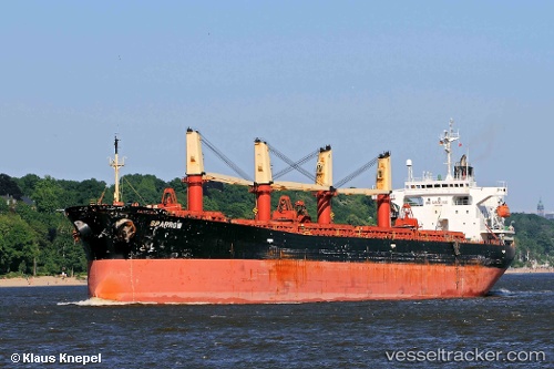
Chang Bao Hai
Current StatusWhere is the vessel?
Chang Bao Hai is currently in Near Yizheng, based on AIS data received about 1h ago.
Latest AIS update:
Current position: 32.20485° N, 119.24698° E (Near Yizheng)
Average speed (last 7 days): Loading…
Average speed (last 30 days): Loading…
Vessel profile: Chang Bao Hai is a Bulk Carrier with dimensions 31m x 190m.
This page combines live AIS, route history, probable destination signals, nearby traffic, and port activity for practical vessel monitoring.
The current position of vessel Chang Bao Hai is 32.20485 lat / 119.24698 lng. Updated: 2026-04-12 21:25:11 UTCNearest reference points:
- Near Yizheng
- Near Zhenjiang Pt
- Near Zhenjiang
Details:
Live Vessel Chang Bao Hai Analytics (details, animations, etc.)
Recent AIS points (UTC):
2026-04-12 15:41:56 UTC · 32.20333, 119.24667 · SOG 0 kn · COG -1°2026-04-12 18:02:57 UTC · 32.20333, 119.24667 · SOG 0 kn · COG -1°
2026-04-12 19:23:55 UTC · 32.20333, 119.24667 · SOG 0 kn · COG -1°
2026-04-12 21:25:11 UTC · 32.20485, 119.24698 · SOG 0 kn · COG 303°