 vesseltracker.com
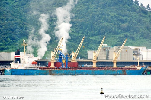
 Xing Qiang 9
Current Status
Where is the vessel?
Xing Qiang 9 is currently in Near Zhangjiagang, based on AIS data received about 1h ago.
Latest AIS update:
Current position: 32.02740° N, 120.38732° E (Near Zhangjiagang)
Average speed (last 7 days): Loading…
Average speed (last 30 days): Loading…
Vessel profile: Xing Qiang 9 is a Bulk Carrier with dimensions 189m x 32m.
This page combines live AIS, route history, probable destination signals, nearby traffic, and port activity for practical vessel monitoring.
The current position of vessel Xing Qiang 9 is 32.02740 lat / 120.38732 lng. Updated: 2026-03-29 03:31:38 UTCNearest reference points:
- Near Jingjiang Pt
- Near Zhangjiagang
- Near Jiangyin Pt
Currently sailing under the flag of China ![]()
Xing Qiang 9 built in 2000 year
Deadweight:
50244 tDetails:
Live Vessel Xing Qiang 9 Analytics (details, animations, etc.)
Recent AIS points (UTC):
2026-03-28 22:00:05 UTC · 32.00673, 120.60909 · SOG 7.2 kn · COG 303°2026-03-29 00:05:54 UTC · 32.02714, 120.39025 · SOG 1.9 kn · COG 236°
2026-03-29 01:28:36 UTC · 32.02739, 120.38728 · SOG 0.1 kn · COG 230°
2026-03-29 03:31:38 UTC · 32.02740, 120.38732 · SOG 0 kn · COG 230°