 vesseltracker.com
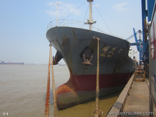
 Tong Mao 9
Current Status
Where is the vessel?
Tong Mao 9 is currently in Near LINKOU, based on AIS data received less than 1h ago.
Latest AIS update:
Current position: 25.24959° N, 121.22809° E (Near LINKOU)
Average speed (last 7 days): Loading…
Average speed (last 30 days): Loading…
Vessel profile: Tong Mao 9 is a General Cargo Ship with dimensions 112m x 17m.
This page combines live AIS, route history, probable destination signals, nearby traffic, and port activity for practical vessel monitoring.
The current position of vessel Tong Mao 9 is 25.24959 lat / 121.22809 lng. Updated: 2026-04-15 03:39:16 UTCNearest reference points:
- Near Sha-lun
- Near Bali
- 11 nm NE of Bali
Currently sailing under the flag of China ![]()
Details:
Live Vessel Tong Mao 9 Analytics (details, animations, etc.)
Recent AIS points (UTC):
2026-04-14 20:12:07 UTC · 24.94534, 120.17545 · SOG 10.4 kn · COG 76°2026-04-14 22:04:34 UTC · 25.05234, 120.49829 · SOG 9.6 kn · COG -1°
2026-04-14 23:49:06 UTC · 25.16391, 120.78609 · SOG 10 kn · COG 69°
2026-04-15 03:39:16 UTC · 25.24959, 121.22809 · SOG 2.3 kn · COG 296°