 vesseltracker.com
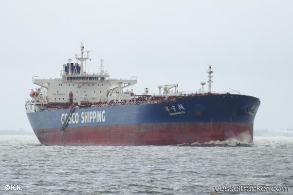
Yang Ning Hu
Current StatusWhere is the vessel?
Yang Ning Hu is currently in 89 nm W of Isla Guarello, based on AIS data received about 1h ago.
Latest AIS update:
Current position: 52.48720° S, 76.10747° W (89 nm W of Isla Guarello)
Average speed (last 7 days): Loading…
Average speed (last 30 days): Loading…
Vessel profile: Yang Ning Hu is a Oil Products Tanker with dimensions 42m x 245m.
This page combines live AIS, route history, probable destination signals, nearby traffic, and port activity for practical vessel monitoring.
The current position of vessel Yang Ning Hu is -52.48720 lat / -76.10747 lng. Updated: 2026-04-01 16:08:23 UTCDetails:
Live Vessel Yang Ning Hu Analytics (details, animations, etc.)
Recent AIS points (UTC):
2026-04-01 09:59:45 UTC · -52.89707, -75.62054 · SOG 4.1 kn · COG 321°2026-04-01 11:25:46 UTC · -52.79001, -75.69089 · SOG 4.6 kn · COG 319°
2026-04-01 13:41:08 UTC · -52.65630, -75.87678 · SOG 4.8 kn · COG 309°
2026-04-01 16:08:23 UTC · -52.48720, -76.10747 · SOG 4.9 kn · COG 318°