 vesseltracker.com
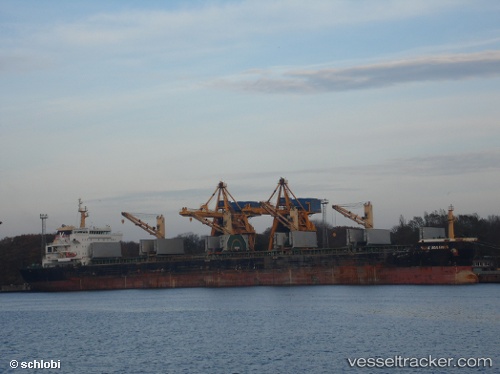
 HENG TAI HONG
Current Status
Where is the vessel?
HENG TAI HONG is currently in 92 nm NE of Sanya Pt, based on AIS data received about 2h ago.
Latest AIS update:
Current position: 34.57167° N, 121.84667° E (92 nm NE of Sanya Pt)
Average speed (last 7 days): Loading…
Average speed (last 30 days): Loading…
Vessel profile: HENG TAI HONG is a Bulk Carrier with dimensions 23m x 190m.
This page combines live AIS, route history, probable destination signals, nearby traffic, and port activity for practical vessel monitoring.
The current position of vessel HENG TAI HONG is 34.57167 lat / 121.84667 lng. Updated: 2026-04-19 10:20:31 UTCNearest reference points:
- 85 nm NE of Sanya Pt
- 89 nm NE of DAFENG
- 93 nm SE of Nudao
Currently sailing under the flag of China Peopless Republic ![]()
HENG TAI HONG built in 2010 year
Deadweight:
56865 tDetails:
Live Vessel HENG TAI HONG Analytics (details, animations, etc.)
Recent AIS points (UTC):
2026-04-19 07:52:45 UTC · 34.68165, 121.31504 · SOG 10.8 kn · COG 108°2026-04-19 09:35:29 UTC · 34.60833, 121.67500 · SOG 11 kn · COG -1°
2026-04-19 09:35:29 UTC · 34.60833, 121.67500 · SOG 11 kn · COG -1°
2026-04-19 10:20:31 UTC · 34.57167, 121.84667 · SOG 11 kn · COG -1°