 vesseltracker.com
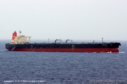
 KASAGISAN
Current Status
Where is the vessel?
KASAGISAN is currently in 13 nm W of Colombo, based on AIS data received less than 1h ago.
Latest AIS update:
Current position: 7.00538° N, 79.64244° E (13 nm W of Colombo)
Average speed (last 7 days): Loading…
Average speed (last 30 days): Loading…
Vessel profile: KASAGISAN is a Crude Oil Tanker with dimensions 60m x 333m.
This page combines live AIS, route history, probable destination signals, nearby traffic, and port activity for practical vessel monitoring.
The current position of vessel KASAGISAN is 7.00538 lat / 79.64244 lng. Updated: 2026-04-23 06:02:11 UTCNearest reference points:
- 19 nm SW of Bataduwa
- 67 nm SW of Moratuwa
- 82 nm W of Moratuwa
Currently sailing under the flag of India ![]()
KASAGISAN built in 2006 year
Deadweight:
302478 tDetails:
Live Vessel KASAGISAN Analytics (details, animations, etc.)
Recent AIS points (UTC):
2026-04-23 01:23:07 UTC · 7.00511, 79.64210 · SOG 0 kn · COG 152°2026-04-23 03:23:03 UTC · 7.00552, 79.64267 · SOG 0.1 kn · COG 167°
2026-04-23 04:02:08 UTC · 7.00527, 79.64240 · SOG 0 kn · COG 158°
2026-04-23 06:02:11 UTC · 7.00538, 79.64244 · SOG 0.1 kn · COG 158°