 vesseltracker.com
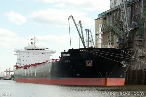
Golafruz
Current StatusWhere is the vessel?
Golafruz is currently in 20 nm E of Basrah Oil Terminal, based on AIS data received less than 1h ago.
Latest AIS update:
Current position: 29.84732° N, 49.19123° E (20 nm E of Basrah Oil Terminal)
Average speed (last 7 days): Loading…
Average speed (last 30 days): Loading…
Vessel profile: Golafruz is a Bulk Carrier with dimensions 32m x 225m.
This page combines live AIS, route history, probable destination signals, nearby traffic, and port activity for practical vessel monitoring.
The current position of vessel Golafruz is 29.84732 lat / 49.19123 lng. Updated: 2026-04-10 03:55:23 UTCNearest reference points:
- 15 nm S of Imam Khomeini Pt/ Mahshahr City
- 11 nm SW of Basrah Oil Terminal
- 19 nm SW of Soroosh (Cyrus) Terminal
Details:
Live Vessel Golafruz Analytics (details, animations, etc.)
Recent AIS points (UTC):
2026-04-09 22:10:18 UTC · 29.85019, 49.18901 · SOG 0 kn · COG 125°2026-04-09 23:40:00 UTC · 29.85034, 49.18933 · SOG 0.1 kn · COG -1°
2026-04-10 02:28:09 UTC · 29.84720, 49.19040 · SOG 0 kn · COG 0°
2026-04-10 03:55:23 UTC · 29.84732, 49.19123 · SOG 0 kn · COG -1°