 vesseltracker.com
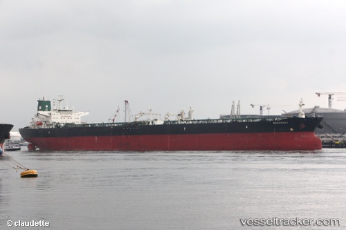
Sabiti
Current StatusWhere is the vessel?
Sabiti is currently in Near Sambu, based on AIS data received about 1h ago.
Latest AIS update:
Current position: 1.20454° N, 103.86591° E (Near Sambu)
Average speed (last 7 days): Loading…
Average speed (last 30 days): Loading…
Vessel profile: Sabiti is a Crude Oil Tanker with dimensions 48m x 274m.
This page combines live AIS, route history, probable destination signals, nearby traffic, and port activity for practical vessel monitoring.
The current position of vessel Sabiti is 1.20454 lat / 103.86591 lng. Updated: 2026-04-09 09:28:13 UTCNearest reference points:
- Near Sambu
- Near Choa Chu Kang
- Near Singapore
Details:
Live Vessel Sabiti Analytics (details, animations, etc.)
Recent AIS points (UTC):
2026-04-09 04:14:26 UTC · 1.58646, 104.64247 · SOG 10 kn · COG -1°2026-04-09 05:47:53 UTC · 1.41905, 104.45082 · SOG 9.6 kn · COG 238°
2026-04-09 07:51:32 UTC · 1.27465, 104.13956 · SOG 8.8 kn · COG 274°
2026-04-09 09:28:13 UTC · 1.20454, 103.86591 · SOG 11.4 kn · COG 239°