 vesseltracker.com
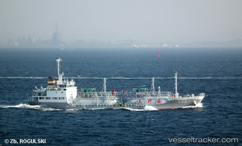
 Shoryu Maru
Current Status
Where is the vessel?
Shoryu Maru is currently in Near Chibai, based on AIS data received less than 1h ago.
Latest AIS update:
Current position: 35.47175° N, 139.98386° E (Near Chibai)
Average speed (last 7 days): Loading…
Average speed (last 30 days): Loading…
Vessel profile: Shoryu Maru is a Lpg Tanker with dimensions 68m x 12m.
This page combines live AIS, route history, probable destination signals, nearby traffic, and port activity for practical vessel monitoring.
The current position of vessel Shoryu Maru is 35.47175 lat / 139.98386 lng. Updated: 2026-04-02 10:07:51 UTCNearest reference points:
- Near ANEGASAKI
- Near Aomi
- Near Kawasaki
Currently sailing under the flag of Japan ![]()
Shoryu Maru built in 2008 year
Deadweight:
986 tDetails:
Live Vessel Shoryu Maru Analytics (details, animations, etc.)
Recent AIS points (UTC):
2026-04-02 03:51:28 UTC · 35.47180, 139.98384 · SOG 0 kn · COG -1°2026-04-02 06:13:08 UTC · 35.47167, 139.98334 · SOG 0 kn · COG -1°
2026-04-02 07:13:08 UTC · 35.47167, 139.98334 · SOG 0 kn · COG -1°
2026-04-02 10:07:51 UTC · 35.47175, 139.98386 · SOG 0.3 kn · COG 336°