 vesseltracker.com
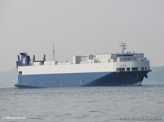
 Nichiyu Maru
Current Status
Where is the vessel?
Nichiyu Maru is currently in 13 nm W of Nishitokyo, based on AIS data received about 1h ago.
Latest AIS update:
Current position: 34.78817° N, 139.28722° E (13 nm W of Nishitokyo)
Average speed (last 7 days): Loading…
Average speed (last 30 days): Loading…
Vessel profile: Nichiyu Maru is a Passenger Ro Ro Cargo Ship with dimensions 159m x 25m.
This page combines live AIS, route history, probable destination signals, nearby traffic, and port activity for practical vessel monitoring.
The current position of vessel Nichiyu Maru is 34.78817 lat / 139.28722 lng. Updated: 2026-04-10 03:55:24 UTCNearest reference points:
- Near Toshima/Tokyo
- Near Nishitokyo
- 15 nm S of Zushi
Currently sailing under the flag of Japan ![]()
Details:
Live Vessel Nichiyu Maru Analytics (details, animations, etc.)
Recent AIS points (UTC):
2026-04-09 22:19:54 UTC · 34.52408, 137.34566 · SOG 18.9 kn · COG 92°2026-04-09 23:23:35 UTC · 34.52655, 137.75346 · SOG 19.1 kn · COG 91°
2026-04-10 01:51:07 UTC · 34.50833, 138.71832 · SOG 20 kn · COG -1°
2026-04-10 03:55:24 UTC · 34.78817, 139.28722 · SOG 15.5 kn · COG 39°