 vesseltracker.com
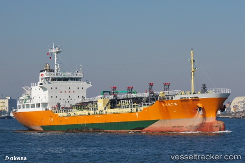
 Naikai Maru No.2
Current Status
Where is the vessel?
Naikai Maru No.2 is currently in Near Sakaide, based on AIS data received less than 1h ago.
Latest AIS update:
Current position: 34.34546° N, 133.87042° E (Near Sakaide)
Average speed (last 7 days): Loading…
Average speed (last 30 days): Loading…
Vessel profile: Naikai Maru No.2 is a Oil Products Tanker with dimensions 98m x 16m.
This page combines live AIS, route history, probable destination signals, nearby traffic, and port activity for practical vessel monitoring.
The current position of vessel Naikai Maru No.2 is 34.34546 lat / 133.87042 lng. Updated: 2026-04-18 11:49:18 UTCNearest reference points:
- Near Sakaide
- Near Ayagawa
- Near TAKAMATSU
Currently sailing under the flag of Japan ![]()
Details:
Live Vessel Naikai Maru No.2 Analytics (details, animations, etc.)
Recent AIS points (UTC):
2026-04-18 05:34:22 UTC · 34.34499, 133.87074 · SOG 0.2 kn · COG 25°2026-04-18 07:52:21 UTC · 34.34537, 133.87042 · SOG 0.1 kn · COG 49°
2026-04-18 10:22:17 UTC · 34.34553, 133.87035 · SOG 0.1 kn · COG 74°
2026-04-18 11:49:18 UTC · 34.34546, 133.87042 · SOG 0 kn · COG 81°