 vesseltracker.com
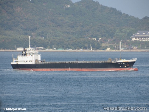
 Kashii
Current Status
Where is the vessel?
Kashii is currently in 12 nm S of HIRAHATA, based on AIS data received less than 1h ago.
Latest AIS update:
Current position: 34.56354° N, 134.60251° E (12 nm S of HIRAHATA)
Average speed (last 7 days): Loading…
Average speed (last 30 days): Loading…
Vessel profile: Kashii is a General Cargo Ship with dimensions 84m x 13m.
This page combines live AIS, route history, probable destination signals, nearby traffic, and port activity for practical vessel monitoring.
The current position of vessel Kashii is 34.56354 lat / 134.60251 lng. Updated: 2026-04-13 15:54:50 UTCNearest reference points:
- Near Awaji
- Near AIOI
- Near KAKOGAWA
Currently sailing under the flag of Japan ![]()
Details:
Live Vessel Kashii Analytics (details, animations, etc.)
Recent AIS points (UTC):
2026-04-13 09:38:51 UTC · 34.70917, 134.83083 · SOG 0.2 kn · COG 292°2026-04-13 11:34:58 UTC · 34.70933, 134.83092 · SOG 0 kn · COG 291°
2026-04-13 13:58:59 UTC · 34.70933, 134.83095 · SOG 0 kn · COG 292°
2026-04-13 15:54:50 UTC · 34.56354, 134.60251 · SOG 11.9 kn · COG 236°