 vesseltracker.com
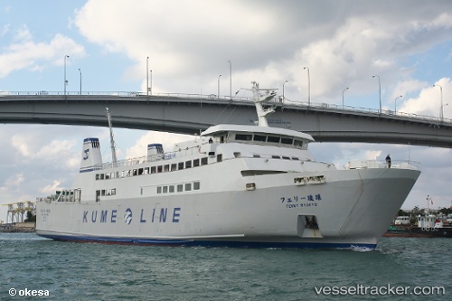
Ferry Ryukyu
Current StatusWhere is the vessel?
Ferry Ryukyu is currently in Near Kumejima, based on AIS data received about 3h ago.
Latest AIS update:
Current position: 26.34099° N, 126.75277° E (Near Kumejima)
Average speed (last 7 days): Loading…
Average speed (last 30 days): Loading…
Vessel profile: Ferry Ryukyu is a Passenger Ro Ro Cargo Ship with dimensions 14m x 84m.
This page combines live AIS, route history, probable destination signals, nearby traffic, and port activity for practical vessel monitoring.
The current position of vessel Ferry Ryukyu is 26.34099 lat / 126.75277 lng. Updated: 2026-04-05 19:12:46 UTCNearest reference points:
- 77 nm SE of Miyakojima
- 18 nm W of Koniya
Details:
Live Vessel Ferry Ryukyu Analytics (details, animations, etc.)
Recent AIS points (UTC):
2026-04-05 03:11:09 UTC · 26.23673, 127.56561 · SOG 18.3 kn · COG 99°2026-04-05 05:19:01 UTC · 26.22897, 127.63042 · SOG 18.9 kn · COG 273°
2026-04-05 07:03:32 UTC · 26.27552, 127.02573 · SOG 19.1 kn · COG 268°
2026-04-05 19:12:46 UTC · 26.34099, 126.75277 · SOG 0 kn · COG 317°