 vesseltracker.com
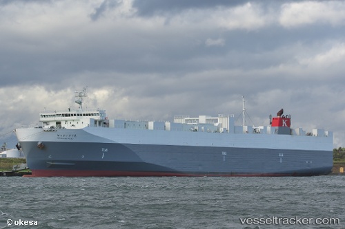
Hokuren Maru
Current StatusWhere is the vessel?
Hokuren Maru is currently in 19 nm SE of KESENNUMA, based on AIS data received less than 1h ago.
Latest AIS update:
Current position: 38.71550° N, 141.90811° E (19 nm SE of KESENNUMA)
Average speed (last 7 days): Loading…
Average speed (last 30 days): Loading…
Vessel profile: Hokuren Maru is a Ro Ro Cargo Ship with dimensions 27m x 173m.
This page combines live AIS, route history, probable destination signals, nearby traffic, and port activity for practical vessel monitoring.
The current position of vessel Hokuren Maru is 38.71550 lat / 141.90811 lng. Updated: 2026-04-01 15:25:57 UTCNearest reference points:
- Near OFUNATO
- Near ONAGAWA
- Near ISHINOMAKI
Details:
Live Vessel Hokuren Maru Analytics (details, animations, etc.)
Recent AIS points (UTC):
2026-04-01 09:38:27 UTC · 36.82356, 140.98004 · SOG 21 kn · COG 26°2026-04-01 11:32:04 UTC · 37.44372, 141.28868 · SOG 21.5 kn · COG 23°
2026-04-01 13:23:15 UTC · 38.04855, 141.58557 · SOG 21.1 kn · COG 19°
2026-04-01 15:25:57 UTC · 38.71550, 141.90811 · SOG 20.8 kn · COG 21°